Ground Survey
A number of factors are taken into account when planning a ground control survey for photogrammetric projects. These include but are not limited to the type of mapping (planimetric, topographic), orthophoto, GIS; the terrain, ground features or accuracies required. For larger projects, the use of airborne global positioning system (ABGPS) and an inertial measurement unit (IMU) would greatly reduce the ground control requirements on the project.
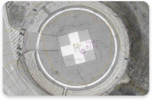
Control locations can be either target panels placed by the surveyor; photo identifiable locations selected from the aerial photography by a photogrammetrist or a combination of both. The target panel locations are provided to the surveyor for placement of target material prior to photo acquisition. After acquisition of the aerial photography, the photo id points are selected and are provided to the surveyor. The coordinate values for each control location is used to register the aerial photography to a known coordinate system for mapping/orthophoto/mosaic during a process called aerial triangulation.
Whenever possible, survey firms/crews local to project site are contracted to perform survey tasks (horizontal/vertical control, boundary surveyors, field reviews), as they would be more familiar with local conditions, regulations and access.