Our Company
 The Base Mapping Co. Ltd. was incorporated in 1986 and has become one of the leading photogrammetric companies in North America.
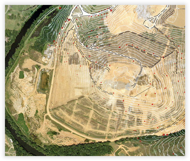
We provide digital mapping and image products for use in civil engineering design, GIS applications, terrain analysis, environmental assessment studies and planning.
Photogrammetric Systems
The Base Mapping Co. Ltd. uses a comprehensive range of softcopy photogrammetric systems allowing us to provide our clients with digital mapping and image products for use in civil engineering design, GIS applications, terrain analysis, environmental assessment studies and planning in a variety of CADD and image formats.
North American Quality
The dedication and commitment of our highly skilled team allows The Base Mapping Co. Ltd. to deliver a premium quality product, on time and within budget to our clients. Our firm has successfully completed over 2500 projects throughout North America and abroad.
The Base Mapping Co. Ltd is very proud that all projects are completed in North America. We use only local technical personnel and specialists.


